Pre-Plan for an area you may be operating in
Often we don’t have the luxury of being familiar with the area the subject is lost, and that is ok. However, a search & rescue team has a responsibility to become familiar with “hot spots” within the geographical area that they are most likely to be called for.
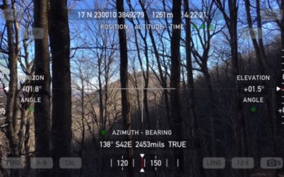
Night Nav

Traditional Map & Compass vs. GPS
Here is a really good article titled “Spatial Orientation and the Brain: The Effects of Map Reading and Navigation”. Alan Padgett shared it on one of the SAR mailing lists. Don’t let the title scare you away. It supports our team focus on traditional land navigation...
NatGeo Appalachian Trail (AT) Maps Now Available in
National Geographic Appalachian Trail map is now available on Gaia GPS for premium members. Learn how to view the map with a step-by-step guide and screenshots.
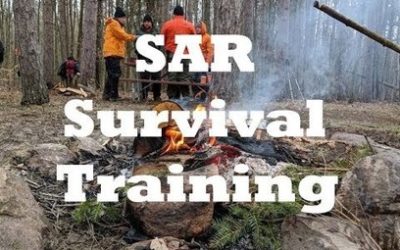
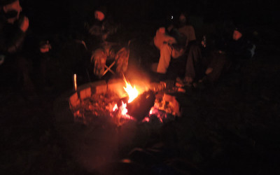
SAR Survival Training
Join Niagara Frontier Search and Rescue’s SAR Academy for their annual survival training. In this introductory course, team members learn and practice skills…
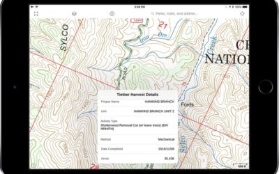
Build Ultimate USFS Maps with Map Overlays
The U.S. national forests (USFS) are home to a wide variety of outdoor activities from backpacking to hunting to overland excursions. The Gaia GPS suite of base USFS maps and premium overlays provide the best offline maps for any of the USFS managed lands.
The 9 Most Popular Hiking Maps in
Start navigating trails near you this summer with the 9 most popular hiking maps in Gaia GPS. Every map contains unique characteristics that offer different tools for navigation. The maps you choose can play different roles in hike planning and preparation.
Wilderness Search and Rescue » NAPSG Foundation
Geographic Information Systems provide a platform to employ modern search strategies like behavioral profiling, probability theory, terrain interpretation and resource management. CRAWL Produce a basic search map and download / display GPS tracks and waypoints. Using GIS and/or mapping software to create paper map products is key here. Team has at least several members with…
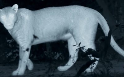
Seeing in the dark and more: Facts and FAQs about thermal imaging
What is thermal imaging? How does it work? And how is it used in wildlife conservation?
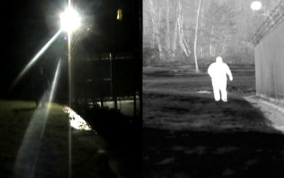
5 Benefits of Thermal Imaging Cameras
Thermal imaging cameras are an integral component in effectively securing borders, airports, seaports, critical infrastructure, and more.
U.S. Forest Service Motor Vehicle Use Maps Now Available – Gaia GPS
Interactive Motor Vehicle Use Maps now available in Gaia GPS. Place the roads on top of any other map layer and tap on the roads to get detailed use info.

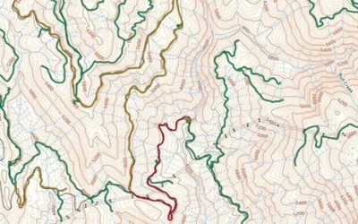
Night Navigation & Search Operations
What Would Happen If You Got Lost In The Woods?
It’s something we think about every time we can’t find the next trail maker, but here’s what would actually happen if you’ve managed to lose your way.
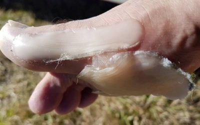
Don’t let damaged feet compromise your Search & Rescue tasking
Firefighter who started Sky Tower climb from Bluff getting the depression message to colleagues.

New MISF Textbook
NASAR and ERI team up to publish new Search Management Textbook
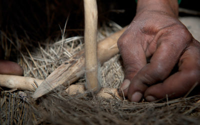
10 Ways To Start A Fire Without Matches
Man’s most important tool.

NextGen Gaia GPS, with National Geographic – Gaia GPS
Today, we released the next generation Gaia GPS app for iOS. We’re also delighted to announce the inclusion of National Geographic Trails Illustrated maps, on iOS, Android, and gaiagps.com. The new app is a huge leap for Gaia GPS, with tremendous technology, new maps and features, and a polished user interface. Since last September, eleven…
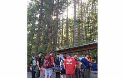
Search Volunteers Rescue 5 In King County Over Memorial Day Weekend
Sammamish-Issaquah, WA – The volunteer King County search and rescue team rescued five people from wilderness danger as of Sunday evening.

Missing Hiker & Dog Found After 6 Days
Illinois native Madeline Connelly and her dog, Mogi, were found safe after being lost for nearly a week in the Montana wilderness.

The Massive Search for 8 Year Old Robert Wood Jr.
This is an extensive article about the search for 8 year old Robert Wood Jr. in Virginia in 2011. It was one of the largest searches in recent Virginia history for a lost child. It's not very often that we have an opportunity to read an in-depth critique of a...