This was originally an article I wrote while on a Wilderness Search & Rescue team. The principles apply whether your doing SAR operations or simply understanding an area that you may have to use as an emergency shelter location.
————————————————————————————————————————————————————————
Often we don’t have the luxury of being familiar with the area the subject is lost, and that is ok. However, a search & rescue team has a responsibility to become familiar with “hot spots” within the geographical area that they are most likely to be called for.
 In the world of SAR, we call this Pre-Planning. Pre-Planning can run the gambit of simple to very complex. I recommend all teams begin with the KISS principle. That is “Keep It Short & Simple”, by simply walking the trail system within those areas being pre-planned.
Start with the main trails and then go to the side trails.
This boots on the ground knowledge is invaluable both in helping the search planner with “ground truth”, and in making you a better resource when having to deploy into the area, probably under less than desirable lighting and weather conditions.
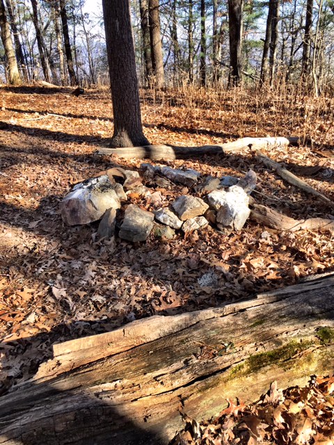
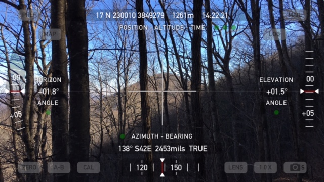
SAR teams should make it a common practice to do a lot of training in the areas they serve, and periodically under nighttime conditions. Not only is it good ground truth education, but it allows you to update maps and note points of interest, such as major/minor decision points, campsites, hazardous areas, etc. Mark those areas with waypoints and transfer the major items to our printed maps. A good pre-plan also notes easy ingress and egress points for teams & rescue personnel.
Doing a pre-plan is not a once and done proposition. It’s important to periodically revisit your pre-plan and update items as needed.
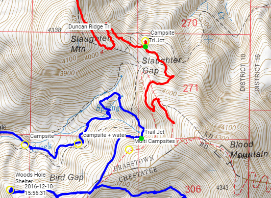
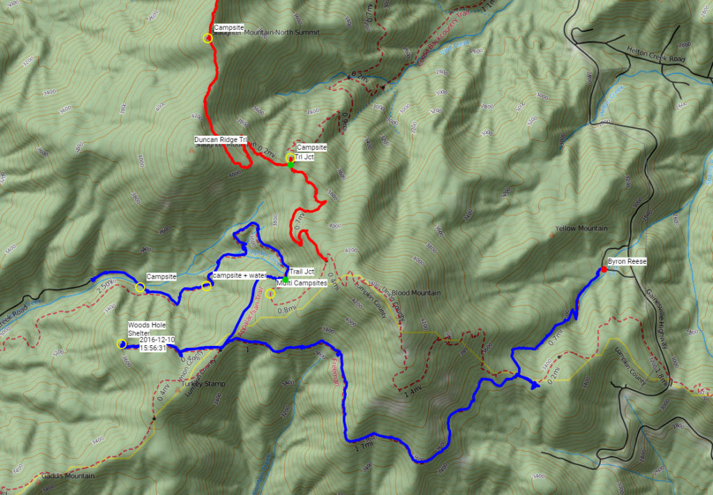
Here is an example of a pre-plan for the busiest section of the Georgia Appalachian Trail system. The area lays between Lake Winfield Scott, Wolfpen Gap, Vogel State Park, Blood Mountain & Neels Gap.
This area includes the following major trails :
- Appalachian Trail
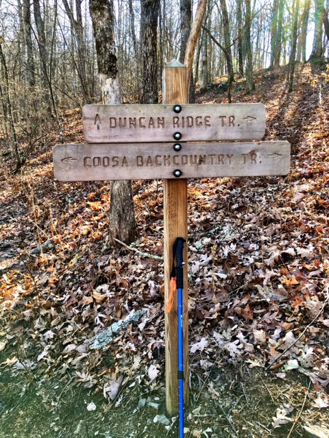
- Duncan Ridge Trail
- Freeman Trail
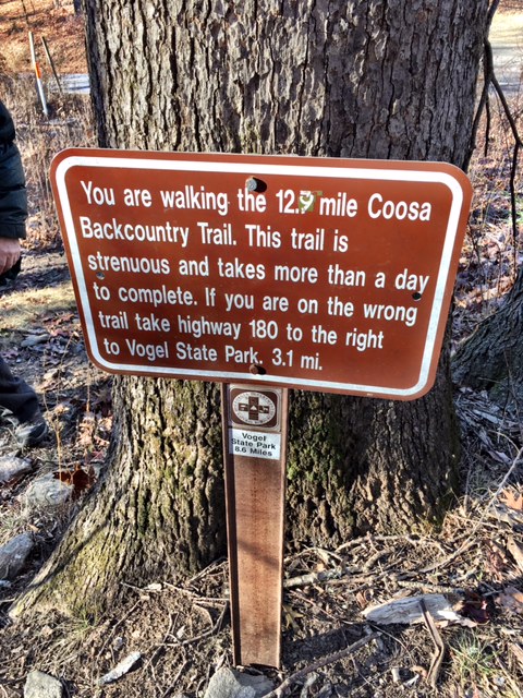
- Coosa Backcountry Trail
Minor trails include:
- Slaughter Creek Trail
- Bear Hair Trail
This area is particularly interesting because over the past 10 years or so, numerous trail re-routes have taken place and a lot of maps still show the older trail paths.
When actually walking a trail in advance, you get the benefit of assessing the risks of walking the same trail at night or during adverse weather conditions. In the pre-plan described above for example, you learn that the Freeman Trail would be EXTREMELY HAZARDOUS during any type of frozen precipitation. You cannot get that info from simply looking at a topo map alone.
Here are some of the results of this pre-plan annotated on the map. (You see updated trail paths, campsites, trail junctions).
The map below was made using an amazing tool at CalTopo.com. They also have a special version specific to Search & Rescue teams. I highly recommends you check them out.
CLICK ON THE MAP TO ACTUALLY OPEN THE WORKING COPY.
So go forth and Pre-Plan !!!
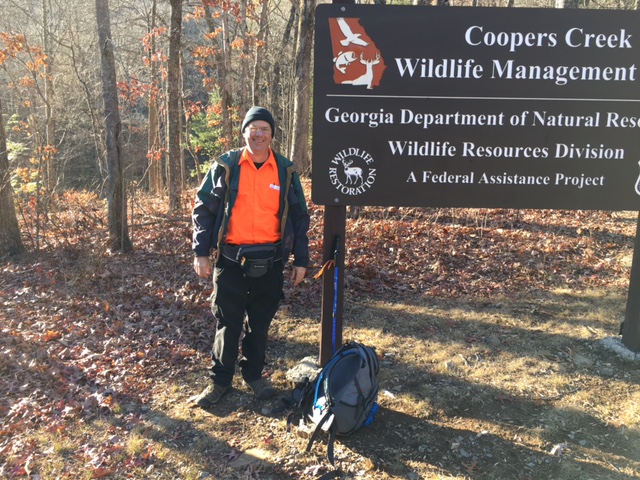
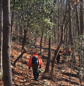
Here are some more pictures from our day of pre-planning :